The Federal Communications Commission (FCC) today approved final rules for a program that will funnel $20.4 billion over ten years to communications service providers to extend fast broadband services to unserved and underserved areas of the U.S.

Scholars at the Brookings Institution are suggesting that Congress invest in a $100 billion package to support 10 potential technology growth centers and foster innovation outside of traditional tech hubs like Silicon Valley.

While AT&T is on track to meet all nationwide First Responder Network Authority (FirstNet) milestones, the Government Accountability Office (GAO) this week flagged schedule, communication, and end-user satisfaction management issues that it said could stop the program from reaching its full potential.

California Secretary of State Alex Padilla announced Jan. 24 that he had “conditionally” certified Los Angeles County’s new publicly-owned voting system.
Cybersecurity and Infrastructure Security Agency (CISA) Director Chris Krebs told the nation’s mayors this week that Federal government needs to ensure that state and local governments have the resources needed to combat growing cybersecurity concerns, and said that heightened security threats from Iran and elsewhere may help provide governments with the leverage to get that done.

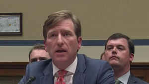
While touting the Federal Communications Commission’s (FCC) efforts to smooth the path for 5G wireless infrastructure and service deployment, FCC Commissioner Brendan Carr told the Senate Commerce, Science, and Transportation Committee today that “accelerating infrastructure deployment [has] created a new challenge and opportunity.”

The National Association of State Chief Information Officers (NACSIO) today released its 2020 Federal advocacy priorities and zeroed in on the importance of cybersecurity.

Sens. Maggie Hassan, D-N.H., John Cornyn, R-Texas, Rob Portman, R-Ohio, and Gary Peters, D-Mich., introduced legislation on Jan. 16 that directs the Department of Homeland Security (DHS) to establish a Cybersecurity State Coordinator program.

The city of Pensacola, Fla., confirmed on Jan. 17 that personal information may have been compromised in a cyberattack on the city’s networks last month, but said that it can’t be 100 percent sure.

The Federal Bureau of Investigation (FBI) unveiled a new, internal policy to improve Federal procedures for notifying state and local officials of election infrastructure cyber threats.